Home » Science, Surveys & Monitoring (Page 7)
Category Archives: Science, Surveys & Monitoring

Diary from the FIDO Bush Regeneration & Monitoring Trip 15-21 Sept 2013
Thinking about getting involved on Fraser Island, then why not join one of our organised trips with either FIDO or CVA? To get a feel of what you might experience during a week long volunteer trip check out John Sinclair’s Diary from his recent trip to Fraser Island. (more…)
CVA Naturewise & QPWS Scat Collection Continues
Early in July a new group of enthusiastic Conservation Volunteers Australia volunteers arrived on Fraser Island to assist QPWS with the dingo scat collection program. As part of the Naturewise program, the volunteers pay for the privilege of picking up poo— what a great way to spend your holidays! (more…)
Fraser Island excites international interest
 The latest news on Fraser Island research will be discussed at a Conference in Brisbane on 8th August to help advance the island’s case for its wider use as a natural laboratory and bring with them a global perspective.
CVA on Fraser Island
 Conservation Volunteers Australia has been working on Fraser Island with different work programs in the last month. (more…)
Join the search for Australia’s finest feral photos!
 The Invasive Animals CRC (IA CRC) are once again searching for your photographs of pest or ‘feral’ animals. They are looking for photos showing pest animals living in the wild, the damage caused by pest animals, and also photos that demonstrate the various methods that are available for pest monitoring and humane control. (more…)
Turtle Nest Relocation – Sandy Cape

Hatchlings scurrying to the water
Turtle nest relocation gallery.
Loggerhead nests are relocated into 4 “dingo proof” hatching pens that are situated back from possible erosion.
Between 60 and 100 nests are relocated each year, which translates to between 6000 and 7000 eggs which dingoes and sea erosion cannot destroy.

The Importance of Monitoring
For almost two decades there has been obvious evidence of sediment flowing off the roads and creating alluvial plumes in places on Fraser Island.
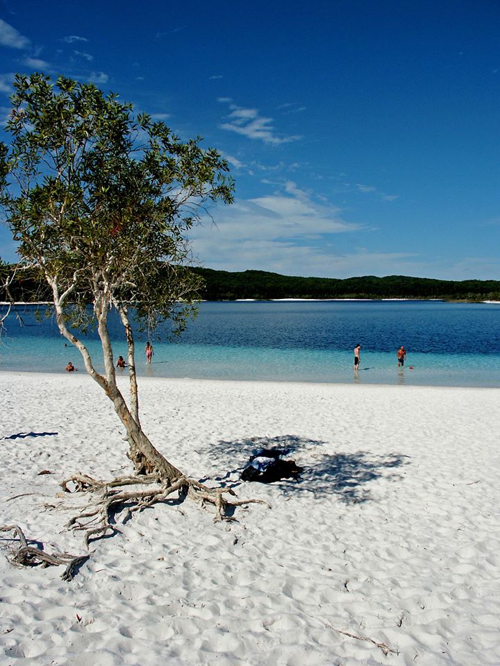
Lake McKenzie (Boorangoora) Photo Monitoring Project
This project is being carried out by FIDO
By John Sinclair – FIDO
Lake McKenzie (Boorangoora) Beach:
In response to criticisms of the modifications to the beach at Lake McKenzie (Boorangoora) in 2010, the QPWS invited the Fraser Island Natural Integrity Alliance to set up a monitoring project on the impacts of recreational use of the lake’s beaches as a basis for future management and decisions relating to the lake.
Monitoring Boorangoora Beach
 At the end of November 2012 the Fraser Island Defenders Organization installed monitoring poles in ten locations to measure the depth and rate of sediment accumulation, mainly as a result of road run-off. (more…)
Shorebird Monitoring
 Dorothy Pashniak
Shorebird monitoring can be both fascinating and frustrating. The fascination happens during summer when there are thousands of birds to watch, photograph, and count. By the end of summer I usually have a list of questions that will take a while for which to find answers – and then the birds are gone on their northern migration. This is the start of the period of frustration.
