 At the end of November 2012 the Fraser Island Defenders Organization installed monitoring poles in ten locations to measure the depth and rate of sediment accumulation, mainly as a result of road run-off.
This was the start of a project aimed to be developed, refined and expanded to subsequently establish data on the impacts and management issues of human environmental impact on Fraser Island can be based.

Of all of Fraser Island’s natural features the most popular and famous Icon is Lake McKenzie (Boorangoora)

Lake McKenzie (Boorangoora) is visited by 220,000 people annually. Preserving its natural integrity is vital

Lake McKenzie (Booranggoora) Beach Feb 2011. It had been modified by plantations, garden walls and fences

Lake McKenzie (Booranggoora) Beach Feb 2011 modified with fencing, matting over the sand and a plantation

On 28 November 2012 FIDO installed four photo monitoring sites to visually compare beach changes over time

Pole 1 was installed unobtrusively high on the lunette in a natural blowout on Main beach’s western end

The location of Boorangoora Photo Monitoring pole on 15/3/13

The base of the melalueca in the centre is one focal point looking east along the beach — 28/11/12

Water was lapping around the focal point from Boorangoora 1 on 15/3/13

The base of the melalueca in the centre is one focal point looking east along the beach — 28/11/12

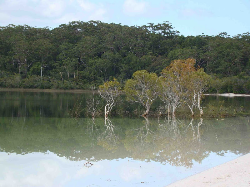
This is the same view on 15 March 2013 with the water risen almost a metre

Lake McKenzie (Boorangoora) Beach on 25 June 2011 taken just below Boorangoora 1 with the same focal point

The base of the small melalueca on the water’s edge is another focal point — 28/11/12

The focal point is almost completely submerged below Boorangoora 1 on 15th March 2013

Boorangoora 2 is located beside the main steps on to Boorangoora’s main beach

Boorangoora 1 and 2 use the same Melalueca as a focal point from different directions — 28/11/12

The same focal point 15/3/13 with water lapping around the stump

Lake McKenzie (Booranggoora) Beach Feb 2011 almost from where Boorangoor

Boorangoora 3 is located adjacent to the steps on the eastern end of the main beach

Another melalueca further east is the focal point for this camera angle — 28/11/12

On 15 March 2013 the base of this melalueca, the focal point was under water

This melalueca is the focal point of one camera angle on this part of the beach — 28/11/12

This melalueca focal point for Boorangoora 3 had water lapping it on s sides in 15 March, 2013

Beach erosion on Boorangoora’s second beach reflects water level rises — 15/3/13

Boorangoora 4 is set high on the lunette of Lake McKenzie’s much less used more pristine second beach

This small melalueca on the water’s edge is a focal point from Boorangoora 4 — 28/11/12

On 15/3/13 the same focal point, the base of the small melalueca was immersed in the lake
