News

Call for Volunteers to work on K’gari, Second Half 2016
FIDO has been conducting week-long working bees to tackle the urban weeds of Fraser Island for more than a decade. With support of other organizations aiming to improve the natural integrity, FIDO is determined to bring the urban weeds in the townships of Eurong and Happy Valley under control. (more…)

Weak Links Push Migratory Birds towards Extinction
University of Queensland scientists are calling for greater international collaboration to save the world’s migratory birds, with research finding more than 90 per cent of species are inadequately protected due to poorly coordinated conservation efforts. (more…)

Launch of the Community Heritage and Icons Grants programme 2015-16 funding round
Yesterday the Minister for the Environment, the Hon Greg Hunt MP, announced the opening of the 2015-16 funding round of the Community Heritage and Icons Grants programme.
The Community Heritage and Icons Grants programme is providing funding for community groups to engage with, and raise awareness of, the places recognised on Australia’s National Heritage List. Individual grants of between $2,500 and $10,000 (GST exclusive) are available. Eligible parties are invited to apply for funding, with applications closing on 22 March 2016.
The Department of Environment would appreciate your assistance in passing this information onto community groups who may be interested in applying for funding under the programme.
Further information about the 2015-16 funding round, including the application form, is available at: http://www.environment.gov.au/heritage/grants-and-funding/community-heritage-icons-grants.

A Little More about Pandanus Dieback
By now I’m sure the vast majority of the readers of the FINIA newsletter are aware of the Pandanus dieback occurring in Pandanus populations in South East Queensland and Northern New South Wales, and the severe dieback currently occurring on Fraser Island. Many will also be aware of the leafhopper primarily responsible for the dieback (Jamella australiae). (more…)

FINIA Members Participate in BMRG Video Case Study
How can you prove that a group is more than just the sum of its parts? This is one of the questions the Burnett Mary Regional Group (BMRG) recently posed when asked what their organisation contributes and how their sustained support can actually enhance delivery through regional partnerships? (more…)
Situation Vacant: Green Army Participants Wanted for Dream Job in Paradise!
Conservation Volunteers Australia is currently seeking six Green Army participants for their project, Restoring the balance in weed and erosion management on Fraser Island (Phase 1), commencing in late February for 20 weeks.
Participants will stay 4 days per week on Fraser Island (K’Gari) and will also be provided with all the tools, personal protection equipment and training required for each project.
If you know someone (or are) aged between 17 and 24, who is an Australian citizen or permanent resident that would like to be a part of a team that will make a real difference to the environment in our local community, please encourage them to apply.
Participants are paid an allowance while gaining skills, training and experience that can help them enter the workforce, improve their career opportunities or further their education and training.
The Green Army is an Australian Government initiative open to young people, including Indigenous Australians, school leavers, gap year students, graduates and job seekers, who are looking for employment to develop skills, undertake training and gain experience in the delivery of conservation. Local transport to the project site is also provided.
For more information or to apply, please check out CVA’s website: http://conservationvolunteers.com.au/green-army/queensland/
Submitted by Conservation Volunteers Australia

Fraser Island to Benefit from Commonwealth Funding for Green Army Projects
The Fraser Island Defenders Organization has been provided with funding as Project Host as a result of Green Army funding for two projects from the Department of Environment and Heritage. The service provider for these projects will be Conservation Volunteers Australia.
The project, Restoring the balance in weed and erosion management on Fraser Island, will commence in late February and again in mid-August and run for 20 weeks. The six participants will range from 17 to 24 years old, and will be provided with training, including Occupational Health and Safety, First Aid, chemical use and the management of small motors. They will gain hands on skills in weed management, erosion control and will be fortunate to have advice and information from the QPWS rangers who will direct the work plan.
The participants will have their training at Hervey Bay and spend four days a week on Fraser Island working on different parts of the island. Other potential work may include:
- Easter Cassia management around Happy Valley and south to Yidney scrub
- Jamella – egg raft collection (and wasp release if training were provided), monitoring and leaf stripping
- Giant Rat’s Tail Grass control
- Eurong nursery – plant propagation and re-potting, including of Pandanus
- Great Walk track maintenance
- Track building
- Site stabilisation through erosion control and weed management on Indian Head (Takky Wooroo).
The project provides a unique opportunity to have work carried out on Fraser Island over the period of a year that would possibly take many years otherwise.
The team will work with a number of different groups on the island, including the Butchulla people, to learn about the culture and management of the island.
Libby Gardiner, Regional Manager Southern Queensland, CVA

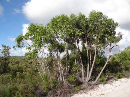
Propagating Natives instead of Weeds
Since Fraser Island’s World Heritage nomination was prepared 25 years ago, the number of identified weeds has grown from 40 to 200. Most of the additions to the weed list are garden escapees or alien grasses and pasture plants.
Most of these alien grasses and pasture plants have arrived on K’Gari as hitchhiking seeds stuck in the under-bodies of vehicles that haven’t been cleaned adequately before going to the island, or in the luggage and freight brought inside those vehicles by island visitors. This is evident by the fact that the epicentres for the invasion of almost all of the grasses and pasture plants, such as Green Panic and Siratro, are in the township or camping reserves. By diligence, we are whittling away at these weeds that arrived essentially as stowaways.
A more difficult challenge is countering the weeds that were deliberately taken to Fraser Island as garden plants. Landholders sought to establish hardy plants that could thrive on the island with little care or attention when they were absent for long periods. Thus they came up with a group of plants that were ideal to survive if they got loose in the Fraser Island bush. Roses and many of the more classic garden plants just can’t survive on Fraser Island. However, garden plants like Clivias, Coral Creeper, Singapore Daisy, Easter Cassia, Mother-in-Law’s Tongues, Glory Lily, Mother of Millions and Fish-bone Ferns, which looked attractive around the houses and required little care, all escaped their garden enclosures and ran riot on the island. Because these plants are so hardy they are now very difficult to eradicate.

Coolum-based volunteer, Suzanne Wilson, gathering seed for the Eurong QPWS nursery. These are attractive plants that can be grown by Fraser Island landholders
Landholders are being encouraged to plant and cultivate attractive native plants. However, sourcing those plants has been a major problem. The Queensland Parks and Wildlife Service has a nursery, but lacks the staff to operate it as a supplier of plants on demand to landholders who are told not to take any plants at all onto the island.
Now, as another FINIA collaboration, FIDO and the Fraser Island Association are building up a stock of plants to entice landholders to opt to grow natives that are grown from seed collected on the island, and which, with a little tender loving care to establish them, can do just as well as the weeds we are working to eliminate. As well as purchasing pots and other nursery supplies, FIDO has been scrounging cleaned used pots and recruited a very experienced seed collector to help build up the nursery.
The resorts at Eurong and Happy Valley have set the tone by purging their properties of weeds and establishing wonderful rich gardens of natives. FIDO is prepared to cooperate with other landholders to replace exotic plants with plants from the Eurong Nursery as part of a long-term strategy to reduce weeds on Fraser Island.
John Sinclair (AO), FIDO

K’Gari’s Six Dune Systems
In this FIDO Backgrounder, rhyme describes the nexus between K’Gari’s soil formation and vegetation types.

Dune System One/ The soil has just begun/ With A and B little or none/ And the ecosystem is underdone.
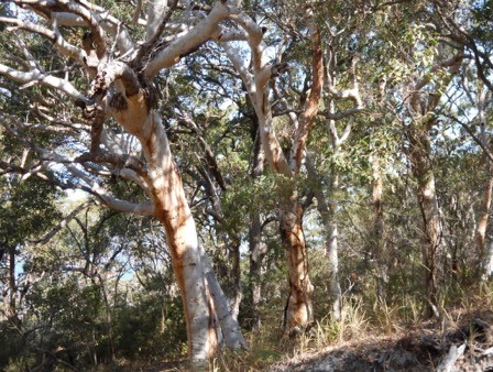
Dune System Two/ B’s got a darker hue/ Eucalypts are now in view/ But soil development has much to do.

Dune System Three/ Has many a Blackbutt tree/ Richer horizon B and nutrients the key/ The forest resulting is grand to see.

Dune System Four/ Gets the highest score/ B horizon is further below the floor/ It supports rainforests and much more.

Dune System Five/ The ecosystems losing its drive/ Tall trees shrink just to stay alive/ Roots can’t reach the B, though they strive.
Dune System Six/ The ecosystem is in a fix/ Tall trees have turned into Mallee sticks/ Reaching deeper nutrients defies all tricks.
John Sinclair (AO), FIDO

Weeds of the Month – Please keep your eyes open for these!
Inspections in Fraser Island townships continue every May and November, with great work occurring with the volunteer groups and residents.

Look out for—Sisal hemp
There are still plants being brought over from the mainland seen without any known quarantine. Please think before bringing plants to the island to reduce the potential for spreading disease and pests.
We are hoping that we have tackled most of the large broad-leaved peppers in Happy Valley, but if anyone knows of any more please let us know. This also applies with the spotting of Easter Cassia and umbrella trees in Eurong.
This work could not be achieved without all FINIA associates’ assistance. Thank you.
Sisal hemp (Local Law No. 3)
Agave sisalana
- A succulent plant from Mexico, originally cultivated for its fibre.
- Tough rosette of thick sword-shaped, smooth-edged leaves to two metres.

Native alternative—Swamp Lily (Crinum sp.)
- flowers green/yellow on a long central stem to over 5m
- Rhizomes sucker from the base and plantlets grow from flowering stem.
- found in rocky hillslopes, roadsides, beach dunes and older gardens.
- Carefully hand remove and bag when small.
- Chemical control by applying glyphosate through stem injection or cut, scrape and paint. Apply picloram and triclopyr (e.g., Access) at 1:60 mix with diesel using basal bark method (PER11463).
- Before using any herbicide, always read the label carefully and apply strictly in accordance with directions on the label.
